Surf’s Up at the Maine Sustainability and Water Conference

photo (6)


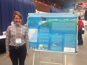
Yesterday I had the pleasure of attending the Maine Sustainability and Water Conference in Augusta, ME. Hosted by the Senator George J. Mitchell Center for Sustainability Solutions and the United States Geological Survey, the conference had14 different sessions ranging from Citizen Science to Urban Sustainability to Ocean Acidification. The session of interest to me was Safe Beaches and Shellfish. I am working as a graduate research assistant under Dr. Shannon Rogers. Dr. Rogers is the adviser and project manager for “Exploring the Local Ecological Knowledge of Surfers in Maine and New Hampshire”. This work is part of the New England SusTainability Consortium (NEST),  a solutions-driven, outcome-oriented and place-based sustainability project focused on socio-environmental systems in the Gulf of Maine. The project is a transdisciplinary collaboration between eight universities and colleges in Maine and New Hampshire. The overarching goal of the consortium is to bridge the gap between science and decision making with respect to shellfish bed closures and recreational beach advisories in the Gulf of Maine. Success of the consortium in achieving its goals relies on collaboration between biophysical scientists and social scientists as well as integration across different institutions and states. It is an exciting project to be a part of!

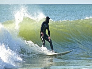
Under the NEST umbrella, Dr. Rogers and I have focused on the surfing population of southern Maine and New Hampshire. We chose surfers because they represent a subpopulation of beach goers that are at a higher risk of suffering from the effects of microbial pathogens. This occurs for a number of different reasons. 1), Surfers are in the water for longer periods of time and become fully emerged (versus wading), 2), surfers participate in the sport year round (seasonal variation in rainfall, changes in waste water treatment plant outputs), 3) given the nature of the sport surfers are more apt to ingest water or get cuts or scrapes, and 4), they often surf during or after storm events when water quality is at the lowest.

Dad_Surf

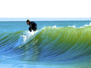
Given the level of pathogen exposure and the corresponding health risk, coupled with a strong sense of environmental sustainability within the local surfing community, Maine and New Hampshire surfers may provide valuable insight and local ecological knowledge into water quality issues. Through this study we hope to gain a better understanding of the local environmental knowledge held within this group and if risk perception plays a role in the decision to surf or not to surf.

surf

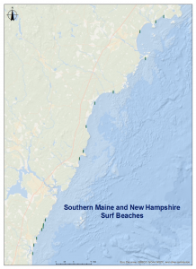
It is certainly the ‘gnarliest’ research around and I’m looking forward to the field season. Soon we’ll be commencing the interview process. The plan is to conduct scoping interviews followed up with intercept surveys and additional in depth interviews. This summer you’ll find me on surf beaches of Maine and New Hampshire! Hopefully I’ll get lessons and ride some Gulf of Maine waves!

 SurfBeaches


My work on NEST is supported by the National Science Foundation’s EPSCoR programs in Maine and New Hampshire.

PSU Applied Learning: Who Says Class Can’t Be Cool?

By Lisa Scott, MS in Environmental Science and Policy student

This semester at Plymouth State University (PSU), my Contaminant Hydrology class had the opportunity to transform a group project on the abandoned Ore Hill mine site into a report for the US Forest Service (USFS). The Ore Hill site is located in the town of Warren, New Hampshire, and was mined for metals from the late 1800s through the early 1900s, before its abandonment in 1915. Acid mine drainage containing high metal concentrations seeping from the site have contributed to unknown ecological impacts overtime. In 2006, the USFS took steps to improve mine site conditions through physical removal of mine tailings and installation of remediation systems on site.

We visited the Ore Hill mine in late September 2014 to assess site conditions. Our visit was extremely valuable for visualizing the site layout and observing water and contaminant flowpaths. We saw building debris where the old mine had existed, and the drip pipe where the contaminant source persists.  As we observed the layout of the site (Slopes, flowpaths, culverts, and vegetation) we were able to see how contaminants move through the system rather than imagining based on reading old reports.

Our class focused on two of the main contaminant removal systems on site: the bioreactor and wetlands. The bioreactor acts as a settling pond to help metals fall out of solution from inflowing water before it is discharged to the lower portion of the site. Although the term “bioreactor” may sound like a deadly experimentation device from a SciFi movie, it is simply used to increase the amount of time metals have to be separated from flowing water.

The second removal system we looked at were the wetlands at Ore Hill. Increased vegetation is often used as an effective contaminant removal system. Phytoremediation is a common term used to describe plants’ ability to uptake contaminants, such as metals, and improve land and water quality. Wetlands have the added benefit of being high in organic matter and low in oxygen. These conditions promote additional metal removal by causing metals to precipitate out, or come out of the water solution. Continue reading

Endless Opportunities

Author: Melissa Leszek, M.S. Candidate, Environmental Science & Policy

The summer before graduating with a bachelor’s degree in environmental science, I made my way up to New Hampshire from northwest Pennsylvania on a conservation internship through the Student Conservation Association (www.thesca.org). This national non-profit organization had placed me in a world I had never visited. A world full of majesty seen in the surrounding pristine lakes and ancient mountains. A world full of endless adventure, endless beauty, endless inspiration, and endless opportunities. I owe my first experience in New Hampshire to the Squam Lakes Association as they accepted me into the area with open arms and trust in my environmental aspirations.

The Squam Lakes Association (SLA) is located about 10 miles east of Plymouth State University and was founded in 1904 to protect the Squam Lakes watershed through Conservation, Education and Outreach programs. In collaboration with local and state partners, the SLA promotes the protection, careful use and shared enjoyment of the lakes, mountains, forests, open spaces and wildlife of the Squam Lakes region. (Please click the link to read Andrew Vielleux’s research study with the SLA):

https://www.plymouth.edu/center-for-the-environment/projects/squam-lake-recreation-management-decision-system/

Photo taken in 2011 on SLA’s milfoil control boat, Millie, which houses a Diver Assisted Suction Harvester (DASH). This unit, designed by SLA Director of Recreation Brett Durham, is the most efficient method identified to remove variable milfoil from Squam. Variable milfoil (Myriophyllum heterophyllum) is an invasive species that can spread rapidly through a water-body, and has been in New Hampshire since the late 1960s.

During my time at the SLA, I was fortunate enough to spend a summer conserving and managing this beautiful area. Some of my responsibilities involved long days on the lake collecting water samples, hours spent in the woods maintaining the surrounding hiking trails, helping ecological interns manage invasive milfoil, or working with my fellow SCA interns to supervise the recreational camping sites located on Moon and Bowman Islands and Chamberlin Reynolds Memorial Forest.

Photo taken on Squam Lake with my fellow SLA conservation interns. Here we set out to different coves around the lake to take water samples for UNH.


I would not trade one moment of that summer as I learned many valuable skills, slept under the stars, and connected with many fascinating people in the area. I had finally found a place where I would enjoy pursuing other ambitions in the environmental field, and had the right channels to do it. My time at the Squam Lakes Association lead me to move to the area permanently after graduating, and eventually connected me to other opportunities in the region such as two years of field biology work for Loon Preservation Committee, and acceptance into the environmental science and policy master’s program at Plymouth State University. Continue reading

Trail Science in the White Mountains

Author: Gregory DiSanto, M.S. Candidate, Environmental Science & Policy

While this might be the first time you have heard of “trail science,” it is not a novel idea. Scientists and trail builders have been studying erosion on hiking trails for a long time, and a lot of thought goes into designing, constructing, and maintaining trails. With over 1200 miles of hiking trails, the White Mountain National Forest is a great laboratory for studying erosion.

The trails in the White Mountains – many of them built in the early 20th century – transport thousands of hikers per year from roadside parking areas to the summits of our ancient mountains, often taking the most direct route possible. Anybody who has hiked a few four-thousand-footers in New Hampshire is familiar with the impacts of erosion and the methods which are often used to limit erosion. The impacts that are most readily apparent are exposed rocks, roots, and soil. Besides being aesthetically unappealing, these impacts can create a trail surface that is loose or slippery. Once erosion on a trail becomes excessive, there are a few possible solutions – stop the flow of water by installing a water bar or other drainage feature, re-routing a section of trail, or armoring the surface of the trail with rock.

Familiar sights to hikers in the White Mountains: erosion on the Old Bridle Path hiking trail (left) and a rock water bar installed on the Dicey’s Mill trail to divert flowing water off of the trail.

Continue reading

Is Total Coliform in your NH Public Drinking Water Supply? In 2015, they Won’t tell you.

Author:  Kristen Melendez, ES&P M.S. candidate, 2016

It’s Thursday, November 6, 2014, at 1:00 pm.  I’m in the auditorium at the NH Department of Environmental Services (DES); the room is packed, with few empty seats in sight.  Public water suppliers from all across the State of NH have filled the room.  Everyone is waiting to hear what Mr. Rick Skarinka, Civil Engineer for NH DES, has to say about how NH DES is going to implement EPA’s Revised Total Coliform Rule (RTCR).

Portion of EPA RTCR Summary Guide; Source: http://water.epa.gov/

This is huge.  The TCR was established by EPA in 1989 and has not been overhauled since.  That is, until revisions were published in the Federal Register on February 13, 2013.  So why all the fuss more than a year and a half later?  EPA has set a compliance date of April 1, 2016 – and NH DES is implementing the rule early.

NH will be the first state in the entire Nation to execute the changes specified in the RTCR.  Beginning January 1, 2015, all NH public water systems will need to comply. Continue reading

Casco Bay Watershed Kids

Last Friday I had the opportunity to talk to two groups of grade six students in Gray, Maine at the Gray-New Gloucester Middle School. Gray is located in the Casco Bay watershed in southern Maine. The Casco Bay watershed comprises only 3% of the state’s landmass but houses 25% of Maine’s population. This is notable since urbanization and population density can have a significant impact on water quality. When speaking with the students I wanted to convey the message that even though the Gray-New Gloucester Middle School is located 23 miles from the coast, local human activities can impact the health of the coastal ecosystem.

Who thought that talking to a room full of sixth graders could cause such trepidation! I’ll admit, the few days leading up to the presentation I was nervous! These stomach butterflies proved to be unwarranted. Not only was I able to actively engage with the kids during my presentation, I had fun doing it! I thoroughly enjoyed working with a young, interesting group of kids. I started by showing the class a Prezi-tation, which was mostly composed of pictures and maps. (You can view my Prezi here.) Instead of showing a slide and explaining to the class what it represented, I asked them to share their interpretation of what they saw. The students were eager to make guesses and used reasoning to infer meaning from the photos and maps I showed.

Continue reading

From Vancouver to Quebec: Presenting My Thesis Work on Lakes


Photo taken at the Vancouver Convention Center with fellow GSA attendees, my thesis advisor Dr. Lisa Doner and fellow student Nadine Orejola

Just in the past few weeks, I have had the opportunity to present at two exciting conferences in Canada. As a second-year masters student I am still in the middle of my thesis work, but I have been working on it since last fall and have preliminary results that show some of the trends I expect to find in my data. My project revolves around water sampling and sediment analyses in Squam and Ossipee, NH lakes. I’m working along with the Squam Lakes Associative and the Green Mountain Conservation Group to give these groups and their members a better perspective of how changing climate will affect the water quality of their lakes.

Presenting my thesis research has been a fantastic experience. I first attended, the annual meeting of the Geological Society of America (GSA) which was held October 18th – 22nd in Vancouver. Vancouver is a very modern, developed city with a very diverse population and we had the opportunity to rent an apartment for our stay in the city near the Vancouver Convention Centre, which was where the meeting was held. The meeting was attended by nearly 7,000 people, most of whom were from the U.S. and Canada. Continue reading

One State, ONE day: 102 Sites Sampled

Although not technically a photograph, we have essentially taken a picture of NH water quality via our “snapshot” sampling events. A total of 102 sites across the state were sampled in ONE day. This happened three times this summer. This was made possible by the many collaborators and partners that make up the Lotic Volunteers for Temperature, Electrical Conductivity and Stage (LoVoTECS) volunteer network. The sensors used in this network continuously record electrical conductivity, temperature and river height data. A group of educators, researchers, government agencies, citizen scientists, members of local river advisory groups and non-profit organizations collect and share the data. They were also the ones to wake up early, go to their sites and take grab samples for these exciting events. This type of event could never have happened without their efforts! Continue reading

Energy and environment; birds of a feather.

At the start of September the New Hampshire Office of Energy and Planning (NH OEP) released the State’s 10 year Energy Strategy. Mandated by the State legislature in 2013, the Strategy examines New Hampshire’s past and current trends in energy resources, demand, and generation to establish a forecast for what the state’s energy needs will be in 2025. That forecast was then compared with the ideal future energy landscape for New Hampshire, built from projected trends in international politics, economics, and environmental conditions. The Energy Strategy presents recommendations as to what needs to be done to steer New Hampshire towards its ideal future energy scenario in the coming decade.

As an intern working with the Energy Strategy team at OEP this past summer, I had the opportunity to contribute to the research, writing, and public input process that went into producing the Strategy. Issues of energy are closely tied to issues of environment, especially in a setting such as New Hampshire where forests, streams, lakes and mountains are central to communities’ cultural identity. Those natural resources are often implicated with the many facets of energy, and require careful consideration throughout the policy process. While issues of energy are not specifically within my research focus, they’re certainly within the same scope of climate adaptation and forward-looking policy that inform my work. This is especially evident in the Renewable Energy and Fuel Diversity chapter of the Strategy, where issues of emissions, nonrenewable resources, and need for resiliency to fluctuating global conditions drive the recommended policy actions. Graduate coursework I have under my belt, such as Environmental Law and Policy, are directly relevant to the work I was handed at OEP. I was able to synthesize discussion on New Hampshire’s renewable portfolio standard and energy facility siting laws, and in turn make contributions to the policy recommendations being made in the Strategy.  It was fulfilling to experience these concepts taking place outside the pages of a textbook, and to connect the dots from classroom to on-the-ground needs. It was also refreshing to spend time in the ‘big city’ of Concord this summer, while still returning to my little mountain town of Plymouth each day. Continue reading

Attention: Stream Crossing Ahead!

Culverts are everywhere. Before this summer, I could drive along without really noticing them. Now, I’m a bit obsessed with them. Why?

For my summer “Part-time, temporary” work, I don waist-high waders and go hunting for where stream systems meet roadways! You see, not all culverts are being inventoried. Some culverts, like driveway culverts, let stormwater flow from one point to another, but stream crossing culverts or bridges allow the waterways to continue underneath the roadways.

 Each day in the field is an adventure.

 My partner and I battle the insects, heat, rain, and poison ivy to locate, inventory, and assess the stream crossings. We have some idea of where they should be, but some scouting is necessary. Sometimes the weather even cooperates to give us beautiful New England summer days!

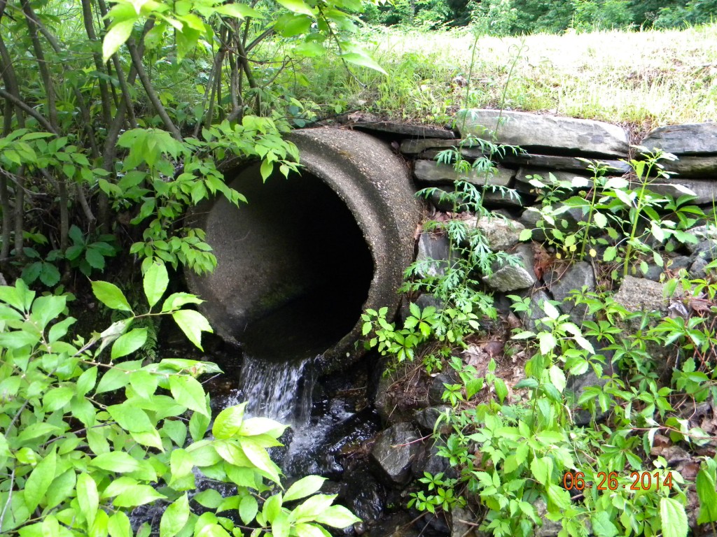
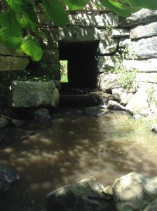
Culverts come in all shapes and sizes. So, we never really know what to expect. For instance, this is a picture of a stone box culvert installed in June 1800 that is still functioning!

Along the way, we interact with the public to explain the need for our work. Why should they care if the culverts don’t allow organism passage or are undersized? Well, small streams or rivers can carry the load of water after major storms. If the culverts are too small, the powerful moving water can do quite a bit of damage. Continue reading